Summer Time Rendering Pilgrimage in Wakayama: Tomogashima & Kada
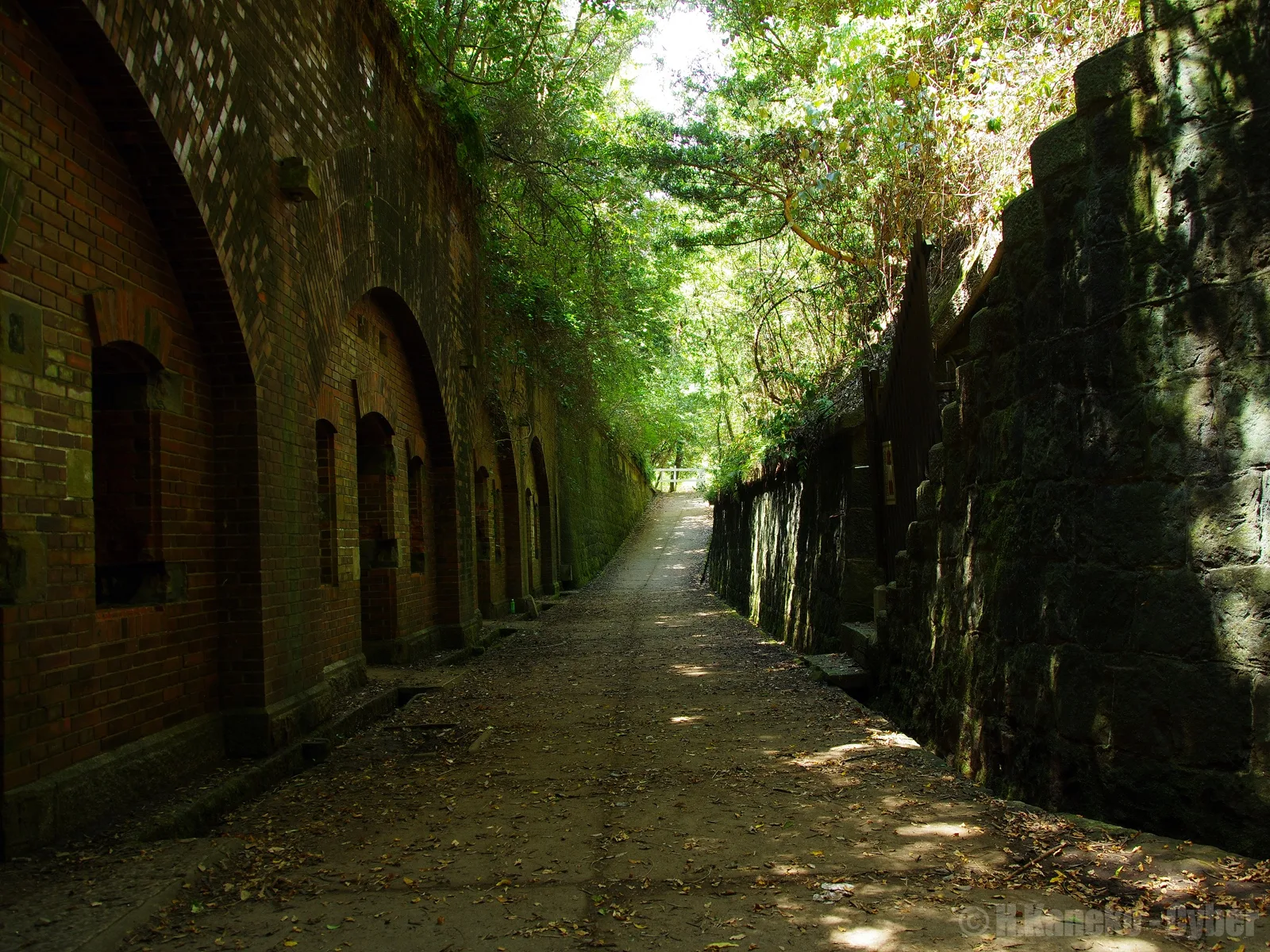
Header photo: brick galleries and a forest path on Okinoshima, near Battery No. 3, photographed in 2013. Photo: Hiroaki Kaneko, CC BY-SA 3.0 (resized; this version is offered under the same licence). Source.
Twenty minutes off the coast of Wakayama, a ferry from the fishing port of Kada lands you on Okinoshima, the largest of the uninhabited Tomogashima islands: red-brick gun batteries from the Meiji era sinking into evergreen forest, a lighthouse above the strait and a square of tall black pines by the pier. The city of Wakayama says the island in Summer Time Rendering is modelled on it. A day here is decided by the boat — when it sails, when the last one leaves the island, and whether it runs at all — so this guide gives a car-free day trip from Wakayamashi Station timed to the ferry, and a two-day version with a night on the mainland that adds Kada’s shrine, sea bream and, if it suits, a hot-spring bath.
Quick Trip Guide
- Series: Summer Time Rendering (サマータイムレンダ), the manga by Yasuki Tanaka (Shueisha) and its 2022 TV anime
- Destination: Tomogashima (Okinoshima island) and the port town of Kada, Wakayama City, Wakayama Prefecture
- Best Gateway: Nankai Wakayamashi Station, then the Kada line to Kada and a 20-minute walk to the ferry
- What You Can See: Five of the seven island spots on the city’s pilgrimage map, on foot, plus the crossing itself. Tora-jima and Shinjaike Pond are closed to visitors
- Main Base: Wakayamashi Station for the day trip; Kada or Wakayama city for the two-day plan
- Getting Around: Kada line, 370 yen each way; the ferry, 2,800 yen return for adults; the island on foot
- Car Needed: No. The island is explored on foot
- Time Needed: Route A: about 7 to 8 hours from Wakayamashi Station and back. Route B: two days. Both are planning estimates
- Check First: The ferry company’s notice on the morning; no sailings on Wednesdays, and only at weekends and on holidays in January and February
- Day Trip: Yes, from Wakayama or Osaka, if the ferry runs
- Best For: readers and viewers who want the island’s ruins and pines without a car, and a seaside town with sea bream for lunch
Why This Place Matters in Summer Time Rendering
Summer Time Rendering, by the Wakayama-born manga artist Yasuki Tanaka, is a time-loop suspense story set on Hitogashima, a fictional island off Wakayama. Wakayama City says Hitogashima is modelled on Tomogashima, a group of four uninhabited islands in the Kitan Strait. The manga ran on Shueisha’s Shonen Jump+, and the TV anime of 25 episodes aired from April to September 2022. The city made its heroine, Ushio Kofune, its first anime tourism ambassador in March 2022.
The city’s pilgrimage map
In 2022, to mark the anime, the city published a pilgrimage map (Japanese) that sets panels from the manga beside photographs of seven places on the island. They are what this guide visits, without reproducing the map or its art:
- 1 — Tomogashima Information Center, by the pier, which the map says appears as the island’s police box.
- 2 — Battery No. 2, on the western shore.
- 3 — The slope up towards Battery No. 1: the path, not the battery itself.
- 4 — The Tomogashima Kisen ferry: the crossing from Kada.
- 5 — The pines, the big black pines in the square in front of Nonaura Pier.
- 6 — Tora-jima, the islet at the eastern end, which is closed to visitors.
- 7 — Battery No. 3, in the woods near the hilltop lookout.
The map is a reading companion, not a timetable: its fares and sailing times are from 2022 and have changed. This guide keeps to where the places are and leaves the scenes, and what happens in them, to the story.
What has ended
The collaborations that followed in 2022 and 2023 — train advertising, an app campaign, panel exhibitions, an event in July 2023, a ferry collaboration ticket and Nankai’s Summer Time Rendering rail pass — were all time-limited. The city’s page marks most of them as finished, and the rail pass sold out in October 2023. Nothing in this guide depends on them.
Anime Pilgrimage Spots
Everything on the island is reached on foot from Nonaura Pier, where the ferry lands. The city signposts a loop of about 3.3 kilometres that it times at about three hours — its “meisho tanbō” sightseeing course on the current closure map — and that loop passes spots 1, 2, 3, 5 and 7, the lighthouse and the hilltop lookout. The three hours are the city’s walking figure; they do not include lunch or waiting for the boat.
Please respect local rules and manners at every location, and follow signs and staff guidance.
Where these places are
The map shows the places below and how far apart they are. It is drawn with OpenStreetMap: opening it loads map images from openstreetmap.org. The list works without it. Seven rows carry an official name or address rather than a published position, so they have a Google Maps link but no pin. Tora-jima and Shinjaike Pond, which are closed, and the pines and the ferry, which have no fixed position, are not listed.
The map could not be loaded. The places are listed below, with their names and a link to each on Google Maps.
- Anime-related places
- Station or transport
- Nearby sight
The 11 places in this guide, 4 of them on the map
- 1Wakayamashi Station和歌山市駅Nankai · Kada line trains start hereIn this guideOpen in Google Maps
- 2Kada Station加太駅Name search · about 20 minutes on foot to the portIn this guideOpen in Google Maps
- 3Kada Port, Tomogashima Kisen pier加太港(友ヶ島汽船のりば)Name search · the ferry to the islandIn this guideOpen in Google Maps
- 4Awashima Shrine淡嶋神社Worship 9:00 to 17:00In this guideOpen in Google Maps
- 5Kyukamura Kishu-Kada休暇村紀州加太Address search · day bath, entry by 15:00In this guideOpen in Google Maps
- 6Nonaura Pier野奈浦桟橋Name search · where the ferry landsIn this guideOpen in Google Maps
- 7Tomogashima Information Center友ヶ島案内センターName search · spot 1; the pines of spot 5 are in the squareIn this guideOpen in Google Maps
- 8Battery No. 2友ヶ島 第2砲台跡Name search · spot 2, seen from outside the fenceIn this guideOpen in Google Maps
- 9Tomogashima Lighthouse友ヶ島灯台The slope of spot 3 leads up here; meridian square beside itIn this guideOpen in Google Maps
- 10Takanosu-yama lookoutタカノス山展望台Published position of the survey point at the lookoutIn this guideOpen in Google Maps
- 11Battery No. 3友ヶ島 第3砲台跡Name search · spot 7, bring a torchIn this guideOpen in Google Maps
Map data © OpenStreetMap contributors, ODbL. Positions were checked on 17 October 2026 against the source recorded for each place; the Takanosu-yama pin is the published position of the survey point at the lookout.
What is closed on the island
- Shinjaike Pond and Tora-jima remain closed to visitors, the city says (page updated 1 August 2026). Its map of 31 July 2026 marks the paths to both as closed; the loop in this guide does not use them.
- The paths themselves have been badly damaged in places by heavy rain, and repairs are under way. Watch your footing.
- The battery interiors have their own rules, given under each battery below.
Nonaura Pier, the information center and the pines
The ferry ties up at Nonaura Pier (野奈浦桟橋), and the grassy Nonaura square behind it is the island’s front door: the Tomogashima Information Center (友ヶ島案内センター, spot 1), toilets, and the tall black pines of spot 5. The pilgrimage map says the thickest and tallest pines stand in this square; it does not single out one tree, and nor does this guide. The square is also the only place on the island where drinks are sold, the city notes.
Battery No. 2
Battery No. 2 (第2砲台跡, spot 2) stands on the low western shore, built to fire across ships entering Osaka Bay through the strait. Storm waves have broken its walls. The inside is off-limits and fenced, the city says, so look from outside the fence; from the sea side behind it you can see across to the Yura district of Awaji Island, the other half of the same fortress.
The slope to Battery No. 1 and the lighthouse
From Battery No. 2 the loop climbs towards the western tip. Spot 3 is this slope, the wooded path up towards Battery No. 1, rather than the battery: the interior of Battery No. 1 (第1砲台跡) is managed by the Japan Coast Guard and normally closed, the city says. At the top are the lighthouse and the meridian square, described under Beyond the Anime.
Battery No. 3
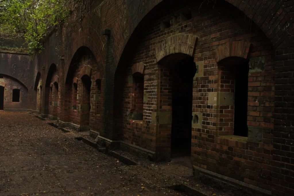
Battery No. 3 (第3砲台跡, spot 7) was the island’s main battery, with bowl-shaped gun pits and an underground level for shells reached by stairs. The city describes it as well preserved and open to look round, with dark passages and uneven floors, and asks visitors to bring a torch. Keep to what the signs and fences allow on the day. It is close to the hilltop lookout on the loop.
The ferry, and Tora-jima from a distance
Spot 4 is the crossing itself: the Tomogashima Kisen ferry from Kada Port is the only regular service to the island. Spot 6, Tora-jima (虎島), is closed: the breakwater that leads to it has partly collapsed and is very dangerous, the ferry company says. The 2022 map adds that it can be seen from boats such as the ferry; there is no way onto it.
How to Get There
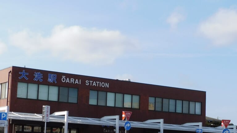
Every route ends the same way: the Nankai Kada line to Kada Station (加太駅), then about 20 minutes on foot to the Tomogashima Kisen pier at Kada Port (加太港), the city says. The station and the port are not the same place, and there is no train to the pier.
From Wakayamashi Station
Kada line trains start at Nankai Wakayamashi Station (和歌山市駅), about 25 minutes from Kada. On Nankai’s route search (Japanese) the 7:55 reaches Kada at 8:19 on a weekday and 8:21 at weekends, for 370 yen, leaving time for the walk to the 9:00 ferry. JR Wakayama Station is a different station: from there, change to the JR Kisei line for Wakayamashi, which Nankai lists as a connection.
From Osaka
From Nankai Namba, the through fare to Kada is 1,010 yen, changing once — at Wakayamashi or, on some trains, at Kinokawa. For the 9:00 ferry, the route search gives the 6:38 from Namba (Kada 8:19) on a weekday and the 6:24 (Kada 7:59) on a Saturday. The Southern limited express’s reserved cars cost extra; its other cars do not.
Nankai’s Kada sightseeing digital ticket (2,120 yen) is a smartphone ticket, bought with a credit card, that covers a return trip to Wakayamashi from Namba, Shin-Imamiya, Tengachaya, Sumiyoshi Taisha or Sakai, a Kada line day pass and coupons for shops in Kada, all on the one chosen day. Two through fares from Namba come to 2,020 yen, so it pays only if you use the coupons or make extra trips on the Kada line. It does not include the ferry. The Kada line’s sea-bream-themed Medetai trains run every day, but which one you get varies, so do not plan the day around a particular train.
From Kansai Airport
Count from Kansai Airport Station, after immigration and baggage. The Nankai trip to Kada changes twice, at Izumisano and at Kinokawa; on the route search the 6:58 reaches Kada at 8:19 on a weekday, for 1,020 yen. There is no direct train to Kada, and an evening arrival is better spent getting to a bed in Wakayama for Route B.
Best Way to Get Around
The ferry to Tomogashima
Tomogashima Kisen (友ヶ島汽船) sails from Kada Port to Nonaura Pier in about 20 minutes. Its fare has been 2,800 yen return for adults since 1 July 2026 (children 1,250 yen). The timetable (Japanese) for March to December is:
- From Kada Port: 9:00, 11:00, 13:00 and 16:00.
- From the island: 9:30, 11:30, 13:30 and 16:30.
- Extra sailings at 10:00 and 15:00 from Kada (10:30 and 15:30 back) run in Golden Week and the summer holidays and on some other busy days. The 15:00 from Kada runs to pick people up from the island; day visitors cannot use it to go across, the company says.
When it sails, and how you get on
- Days: from March to December every day except Wednesday (a Wednesday that is a public holiday sails); in Golden Week and from 20 July to 31 August every day. In January and February only on Saturdays, Sundays and holidays, and not from 29 December to 3 January, the city’s timetable says.
- No advance booking. For the second sailing onwards, numbered boarding slips are handed out on the day; each boat takes 100 people, and at busy times the slips can run out early.
- Weather decides. Whether the boats run is decided on the morning, so it cannot be announced the day before. The company posts the day’s decision on its home page: on 17 October 2026 every sailing was cancelled for strong wind, and on 13 October only the 9:00 and 10:00 sailings ran, with the last boat back at 12:30. On a day like that, a route built on the normal timetable no longer works.
- Luggage: one piece of hand luggage each is free; larger parcels are charged.
On the island
There is no transport for visitors on Okinoshima: you walk. The paths are uneven and rough in places after heavy rain, so wear proper walking shoes and comfortable clothes, as the city advises. There are toilets at Nonaura and east of Jagaike Pond, the ferry company notes. Jagaike, which the loop passes, is a different pond from the closed Shinjaike.
Car
Not needed, and no use on the island. Kada Port has a car park for 700 yen a day, the city says, but roads into Kada can be congested in Golden Week and the summer holidays.
What to Eat and Drink
On the island: bring your own
Plan to carry lunch and plenty of water. The island has one café, Rapyu Café by Nonaura square, for drinks and light meals, but the city’s map notes that it closes on irregular days, and drinks are sold nowhere else on the island. If you are on the 7:55 train, buy food the evening before, and take all your rubbish back to the mainland: the city asks visitors to carry out everything they bring.
Sea bream in Kada
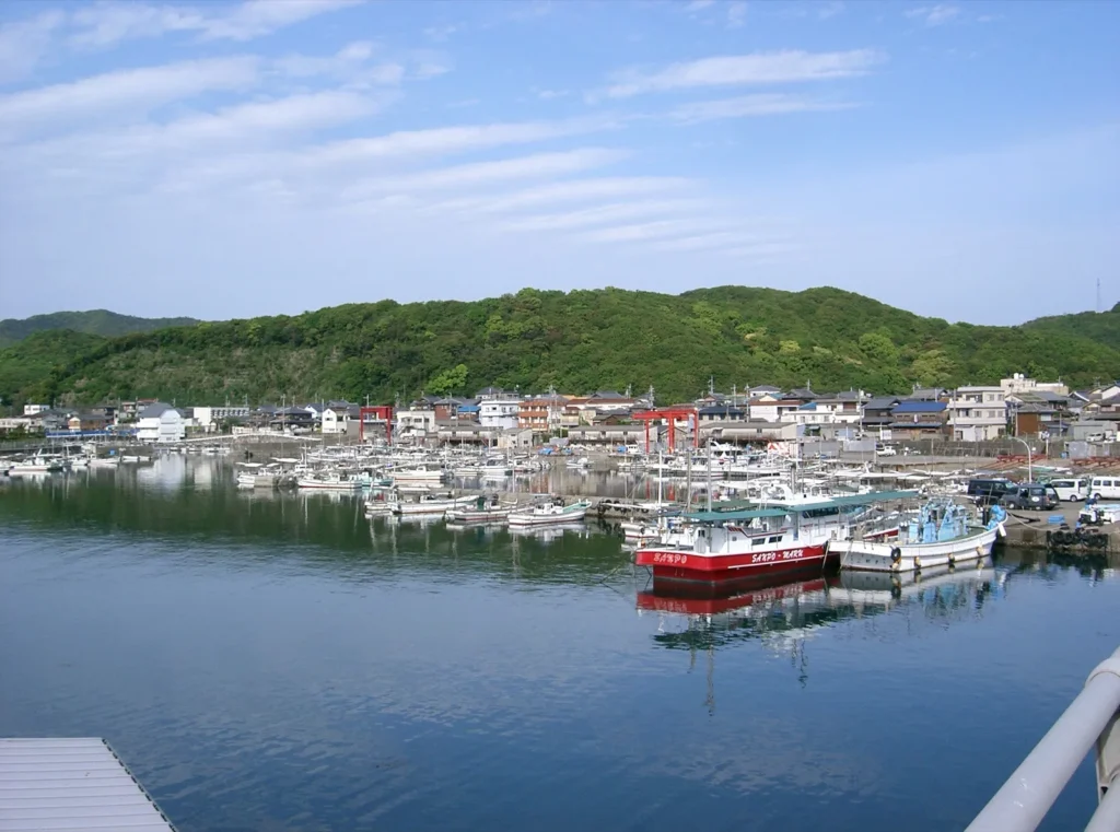
Kada is a fishing town known for line-caught sea bream, its tourism association says. Inasa (活魚料理 いなさ), at Kada 196, serves sea bream and other local fish at lunch from 11:00 to 15:00 (last order 14:30) on Mondays, Thursdays to Sundays and public holidays; it closes on Tuesdays and Wednesdays, its own site says. The association adds that the catch decides what it can serve, so it is worth checking ahead. Coming back on the 13:30 boat, you are in Kada at 13:50, before that last order.
Along the approach to Awashima Shrine, the shrine says, three souvenir shops sell grilled shellfish, yomogi (mugwort) rice cakes and other seafood — a lighter option after the island.
Beyond the Anime
Tomogashima Lighthouse and the meridian square
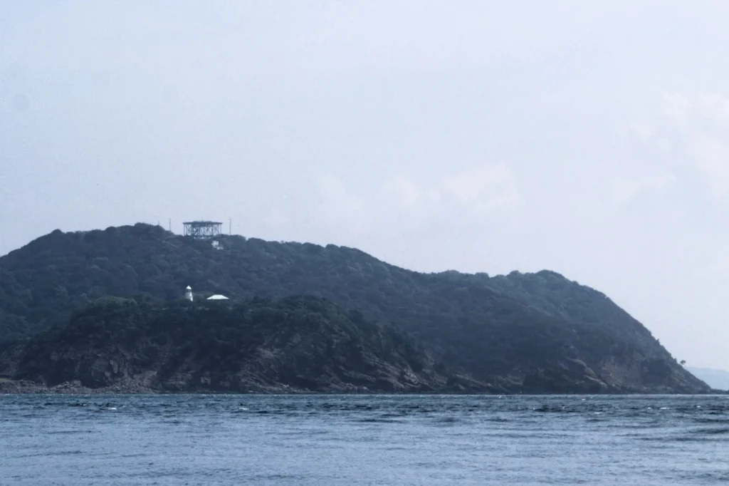
At the western tip, Tomogashima Lighthouse (友ヶ島灯台), a stone lighthouse in Western style, was first lit in 1872 after the British engineer Richard Henry Brunton, brought to Japan to build lighthouses, called for one here. It is still working, and was moved 25 metres inland from its first site when the army built the fortress, the city says. Beside it, the meridian square (子午線広場) marks 135° east, the line that sets Japan Standard Time, at the southernmost point in Japan that it crosses, the city notes.
The fortress, and the lookout above it
Tomogashima was part of the Yura Fortress guarding Osaka Bay. In the Meiji era the army fortified it, with guns across the island and a garrison of about 600 soldiers, and it was closed to the public until the end of the Second World War, the city’s history page says. From the Takanosu-yama lookout (タカノス山展望台) near Battery No. 3, the city’s map describes a view down over the strait to the mountains of Shikoku, Rokko and Izumi-Katsuragi.
Awashima Shrine and Kada town
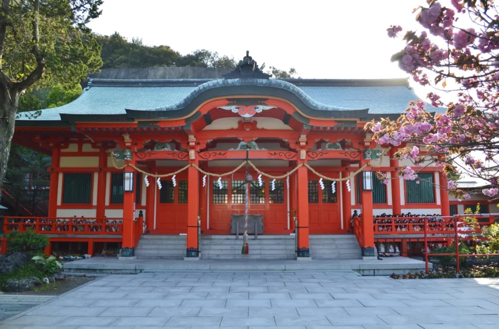
Awashima Shrine (淡嶋神社) is the island’s link on the mainland: its own history tells how its gods were first enshrined on Tomogashima and later moved across to Kada. People bring dolls here to be laid to rest, and rows of them line its buildings; its doll-floating rite is held on 3 March. Worship hours are 9:00 to 17:00, the shrine says. It is not on the pilgrimage map. The Kada Tourism Association’s walking map (Japanese) gives a short course of about 2 kilometres and 35 minutes from Kada Station to the shrine through the old port town.
A hot-spring bath
Kyukamura Kishu-Kada (休暇村紀州加太), a resort hotel in the national park on the hill above the coast, takes day bathers from 12:00 to 15:50, with entry closing at 15:00; adults pay 1,500 yen with a face towel, and people with tattoos are not admitted, it says. Its access page lists a shuttle bus of about 10 minutes from beside Kada Station (for example 11:55, 12:55 and 13:55 up; 13:40, 14:40 and 15:40 down), without saying whether day bathers may use it, so ask when you call. Its maintenance page listed no closures in the region when checked. On a ferry day you are back at Kada Station around 14:10: too late for the 13:55 shuttle, and the next, at 14:55, arrives after entry closes. The bath belongs to the other day of Route B.
Souvenirs
In Kada
The shops on the approach to Awashima Shrine are the obvious place for something from Kada — the shrine names yomogi rice cakes and seafood among what they sell. Kada’s tourism association lists more shops on its food page (Japanese).
What has ended
The collaboration goods, tickets and campaigns of 2022 and 2023 were time-limited, and the series’ rail pass sold out in 2023. Ushio Kofune is still the city’s anime tourism ambassador, and the city’s page is where any new project would appear.
Where to Stay
This guide names no hotels for the night and gives no prices. The choice is about the morning: how you reach the 9:00 ferry.
Wakayama city
A bed near Wakayamashi Station puts you on the 7:55 train and at Kada Port in time for the 9:00, and gives you the city’s restaurants for dinner. It is also the simpler base if you arrive late from the airport.
Kada
Staying in Kada itself means a walk to the port in the morning, fish for dinner and, at several inns, a hot-spring bath; the tourism association lists them (Japanese). Check how you will get to the pier before 9:00: Kyukamura is up the hill, and its first shuttle of the day leaves at 8:40 for the station, from which the pier is another 20 minutes on foot. A night in Kada does not guarantee a crossing; the weather still decides.
Suggested Itinerary
Route A is the island in a day, on the first boat out and the 13:30 back. Route B adds a night and a second day for Kada — the shrine, a sea-bream lunch and, if you want it, a hot-spring bath — and lets you move the island to whichever day the weather is kinder. Both start and end at Wakayamashi Station.
| Which route | A — Tomogashima in a day | B — two days, with Kada |
|---|---|---|
| Time | About 7 to 8 hours from Wakayamashi Station and back: the 7:55 train out, back between about 14:50 and 15:50. A planning estimate | Day A, plus a Kada day of about 4 to 6 hours |
| What you see | Spots 1 to 5 and 7 on the city’s map, the lighthouse, the meridian square and the hilltop lookout | All of A, plus Awashima Shrine, Kada’s old streets and, if it suits, the bath at Kyukamura |
| Transport | Nankai Kada line, the ferry and walking | The same; for the optional bath, Kyukamura’s shuttle only if it takes day bathers (ask) |
| Fares, per adult | Kada line 740 yen return from Wakayamashi and the ferry 2,800 yen: 3,540 yen. From Namba, 4,820 yen with the through fare | A, plus another Kada line return (740 yen) if you sleep in Wakayama city, and 1,500 yen if you add the bath |
| Check first | The ferry company’s notice that morning; no sailings on Wednesdays, and only at weekends and on holidays in January and February | The same, plus Inasa’s closing days (Tuesday, Wednesday) and the bath’s 15:00 entry limit |
| Car | Not needed | Not needed |
A — Tomogashima in a day
- 7:55 from Wakayamashi to Kada (8:19 on weekdays, 8:21 at weekends), then about 20 minutes on foot to Kada Port and a return ticket for the 9:00 ferry, the first of the day. The numbered slips apply from the second sailing.
- About 9:20 at Nonaura Pier. Walk the city’s signposted loop: west along the shore to Battery No. 2, up the slope towards Battery No. 1 to the lighthouse and the meridian square, then inland over the Takanosu-yama lookout to Battery No. 3 and back down to Nonaura. The city times the 3.3 kilometres at about three hours.
- Lunch from your bag in Nonaura square, under the pines, and be back at the pier in good time for the 13:30, the boat this plan depends on. The company’s timetable page gives no boarding deadline, so do not leave it to the last minute.
- 13:50 at Kada. Either a late lunch at Inasa before its 14:30 last order (not on Tuesdays or Wednesdays) or a walk to Awashima Shrine, then the 20 minutes back to the station.
- Trains to Wakayamashi leave Kada at 14:29, 14:59 and 15:29, about 23 minutes each.
If you miss the 9:00, the 11:00 out and 16:30 back also covers the loop, but it needs a numbered slip on the day and leaves you on the last boat; on a windy day the last boat can be brought forward, as it was to 12:30 on 13 October 2026. The 11:00 out with the 13:30 back gives about two hours ashore, less than the city’s three hours for the loop, so shorten the walk rather than race it. Kada line trains after 17:00 include the 17:27.
B — two days, with Kada
- Kada day: a mid-morning train to Kada, the walking course through the old town to Awashima Shrine (about 35 minutes) and lunch at Inasa from 11:00. If you want a bath, Kyukamura takes day bathers until 15:00 entry; its shuttle from beside Kada Station leaves at 11:55, 12:55 and 13:55, if it will take you. Sleep in Kada or back in Wakayama city.
- Island day: Route A, on the 9:00.
- Swap them if the forecast is calmer for the first day: arriving in the morning, the 11:00 out and 16:30 back still fit. The decision is made on each morning, so a night nearby gives you a second chance, not a guarantee.
If the ferry does not run
- Spend the day in Kada instead — the shrine, the harbour, lunch and, if it suits, the bath — or go back into Wakayama city.
- This is not a visit to the island’s spots: none of them can be reached or seen up close from the mainland.
Travel Tips and Etiquette
The ferry
- Check the company’s notice that morning on its home page or by phone (073-459-1333), and again before you set out for the boat back.
- Follow the crew at the pier. Numbered slips, boarding order and any change to the last boat are theirs to decide on the day.
On the island
- Keep off closed paths and out of fenced areas. Shinjaike Pond and Tora-jima are closed, Battery No. 1 is normally shut and Battery No. 2 is fenced; the closure map is updated on the city’s page.
- Take a torch, water and walking shoes, and in summer guard against heatstroke, as the city warns.
- No swimming or rock-pool play. There is no bathing beach on the island, and the city asks visitors not to play in the rocks on the shore; do not try to reproduce scenes at the water’s edge.
- Carry out all your rubbish, light no fires outside the barbecue area and bring no pets except assistance dogs — among the city’s house rules for the island.
Photos, cosplay and drones
Non-commercial photography, cosplay included, needs no permission, the city says, but not in restricted areas, not by occupying part of the island and not in ways that bother other visitors. There is nowhere to change on the island. The island lies under Kansai Airport’s flight paths, so the city asks anyone flying a drone to consult the Osaka Civil Aviation Bureau’s Kansai Airport office first.
Plan Your Trip
Do this first
- Pick a day that is not a Wednesday (or, in January and February, one at a weekend or holiday), and keep a second day free if you can.
- Look at the ferry company’s notice on the morning, and the timetable for the boat back.
- Pack lunch, water and a torch the evening before, and check Inasa or Kyukamura if Kada is part of the plan.
Combine it with another guide
The other Kansai guides on this site, Sound! Euphonium in Uji and K-ON! in Toyosato, Shiga, are separate trips on the far side of Osaka and Kyoto, so none is suggested as a pairing. Every published guide is listed on All published guides, and by region on Destinations.
How this guide was put together
This guide was researched and planned from published sources rather than written up from a visit. Checked on 17 October 2026: Wakayama City’s pages on the series, the island’s closures and paths, the batteries, the lighthouse, the meridian square, filming and the island’s house rules, and its ferry timetable and access page; Tomogashima Kisen for fares, timetables, boarding slips and the day’s notices; Nankai for the Kada line, its route search, the digital ticket and the Medetai trains; the Kada Tourism Association for the town, food, inns and walking map; Awashima Shrine for its hours and history; Inasa for its hours; and Kyukamura Kishu-Kada for its day bathing, shuttle and maintenance days.
What is an estimate, and what could not be confirmed. The 7-to-8-hour and 4-to-6-hour figures and the time spent at each place are editorial planning estimates built from the published times, not official durations; the three hours for the loop are the city’s own figure. The island’s information center, piers and batteries, Kada Station and Kyukamura have no published position that could be confirmed, so the map lists them by name. The ferry’s ticket office hours and payment methods, and whether Kyukamura’s shuttle takes day bathers, were not published in a form this guide could confirm.
Written and edited by Nick, who runs Anime Routes Japan from Japan. More about Nick, and about how these guides are made, is on the About page.
Sailings, opening hours, fares and the island’s open paths change, sometimes on the day. Confirm the ones your day depends on before you travel.
This guide currently contains no affiliate links.