Sound! Euphonium Pilgrimage Guide to Uji, Kyoto, Japan
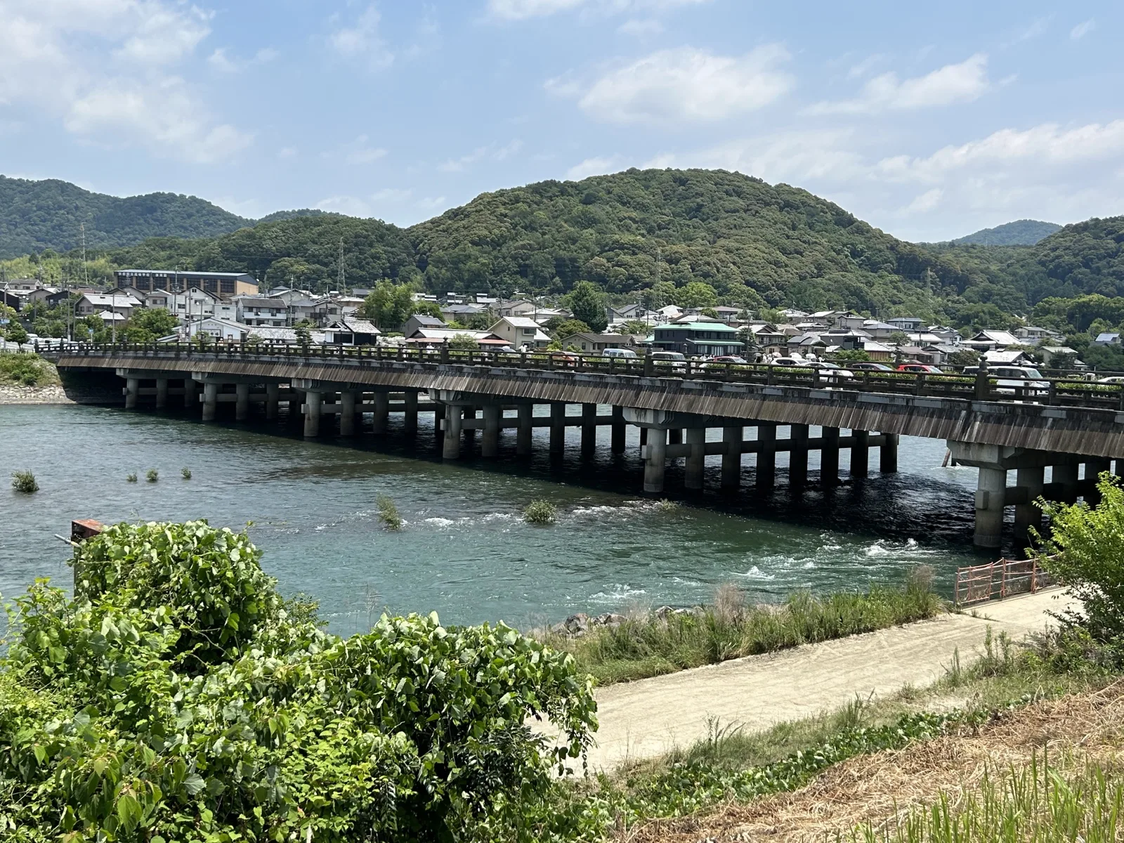
Header photo: Uji Bridge over the Uji River, seen from the left bank. Photographed in 2023. Photo: 京都東, CC BY-SA 4.0 (resized; this version is offered under the same licence). Source.
Sound! Euphonium is a story about a school wind band, and it is set in Uji, a tea town on the river of the same name about sixteen minutes south of Kyoto Station by rapid train. The places on the official location map are not a tour of attractions: a bridge, a riverbank, two shrines on opposite sides of the water, a bench on a riverside path and a hill above the town. The riverside places make a walking loop between the two stations, and the question is how much of the rest of the town you add to it — the tea, the World Heritage temple and the climb to the lookout — which is what the two routes below settle.
Quick Trip Guide
- Series: Sound! Euphonium (響け!ユーフォニアム), Kyoto Animation’s television series and films, made over ten years from Ayano Takeda’s novels
- Destination: Uji, Kyoto Prefecture — a tea town on the Uji River, between Kyoto city and Nara
- Best Gateway: Kansai International Airport, then the Haruka limited express to Kyoto and the JR Nara Line south
- From Kyoto Station: about 16 minutes to JR Uji by Nara Line rapid, the figure Uji City publishes
- Main Base: Kyoto city for a day trip. Uji itself if you want the river early in the morning or in the evening
- Getting Around: On foot. JR Uji is about ten minutes from Uji Bridge by Uji City’s figure, and Keihan Uji is beside it. The hill is a separate climb on a footpath
- Car Needed: No. Uji City asks visitors to come by public transport in the busy seasons, and the car parks by the river are paid
- Time Needed: Route A, the riverside, 3 to 4 hours. Route B, with Byodoin and the hill, 6 to 8 hours. Both are planning estimates that include walking, looking and one sit-down stop
- Day Trip: Yes, from Kyoto or Osaka, for either route
- Best For: readers of the series, tea drinkers, and anyone who wants a World Heritage temple and a river walk in the same day
Why This Place Matters in Sound! Euphonium
The series follows the wind band of a high school in Uji through a competition year: rehearsals, auditions, the slow business of a hundred teenagers learning to play one piece together. The location map that Keihan publishes with Uji City is built from those places — the riverbank, the bridges, the shrines and the hill — and the railway has run collaborations with the series in more than one season.
A band story in a real town
What the trip gives you is the everyday geography of the show rather than a set of landmarks: a river, its bridges, two shrines and a hill above the town, all of it public space. You do not need to have finished the series to enjoy it — and nothing below depends on knowing how any of the storylines end.
What is real, and what is not
Kitauji High School is fictional. There is no school to visit, and this guide does not point you at any school, any house or any other private property. The places it does list are the river, the bridges, the islands, two shrines, a promenade and a hill, all of them in public use, plus the temple and the tea shops that any visitor to Uji would see anyway.
Which Euphonium
Kyoto Animation has made the series over ten years, across television seasons and films, from Ayano Takeda’s novels, and a closing film released in two parts in 2026 completes it. This guide names places rather than scenes, and takes its list of places from Keihan’s map. Where a place carries an official label — a stamp point, a collaboration bus stop — it is Keihan and Uji City doing the labelling, not this site.
The official map, and what this guide does with it
- Keihan publishes a location map for the series, produced with Uji City, as a paper leaflet and a PDF. The Anime Pilgrimage Spots section below follows the central part of that map: the stations, the bridge, the west bank, the islands, the east bank and the hill.
- Beyond the Anime is ordinary Uji sightseeing — Byodoin, Ujigami Shrine, the tea houses — which is not the same thing and is kept separate here. Uji Shrine and Ujigami Shrine are two different shrines a few minutes apart, and the Byodoin Omotesando is the shopping street outside the temple, not the temple grounds.
- The map’s own reproduction is not copied here. The leaflet is given out at major Keihan stations, the Uji City Tourist Centre, the information office outside Keihan Uji Station and Yumeria Uji by JR Uji Station, from 1 September 2026 while stocks last.
Anime Pilgrimage Spots
The riverside places in this section make one loop: over the bridge, along one bank, across the islands and back along the other. The hill is a separate climb from the east bank, there and back. The order below starts from JR Uji Station, for anyone coming from Kyoto Station.
Please respect local rules and manners at every location, and follow signs and staff guidance.
Where these places are
The map shows the places below and how far apart they are. It is drawn with OpenStreetMap: opening it loads map images from openstreetmap.org. The list works without it. Three rows carry an official name or address rather than a published position, so they have a Google Maps link but no pin.
The map could not be loaded. The places are listed below, with their names and a link to each on Google Maps.
- Anime-related places
- Station or transport
- Nearby sight
The 12 places in this guide, 9 of them on the map
- 1JR Uji StationJR宇治駅West bankIn this guideOpen in Google Maps
- 2Keihan Uji Station京阪宇治駅East bankIn this guideOpen in Google Maps
- 3Uji Bridge宇治橋Between the banksIn this guideOpen in Google Maps
- 4Agata Shrine縣神社West bankIn this guideOpen in Google Maps
- 5Uji Park: Tachibanajima and Tonoshima京都府立宇治公園(橘島・塔の島)The islandsIn this guideOpen in Google Maps
- 6Asagiribashi朝霧橋Islands to east bankIn this guideOpen in Google Maps
- 7Uji Shrine宇治神社East bankIn this guideOpen in Google Maps
- 8Daikichiyama lookout大吉山展望台Name search only, no published positionIn this guideOpen in Google Maps
- 9Byodoin平等院West bankIn this guideOpen in Google Maps
- 10Ujigami Shrine宇治上神社East bankIn this guideOpen in Google Maps
- 11Ajirogi-no-michi and the Igawa pumping station frontあじろぎの道・井川用水機場前Address only, no published positionIn this guideOpen in Google Maps
- 12Nakamura Tokichi, main shop中村藤吉本店Address only, no published positionIn this guideOpen in Google Maps
Map data © OpenStreetMap contributors, ODbL. Positions were checked on 16 October 2026 against the source recorded for each place.
Uji Bridge, and the two stations
The bridge is the hinge of the whole walk: it joins the two banks, and with them the two stations. It is on Keihan’s location map and a stamp point in the campaign’s first half. Uji City gives it as ten minutes on foot from JR Uji Station, with Keihan Uji right beside it on the east bank.
Traffic uses the bridge as well as people on foot, so step to the side of the footway to take photographs rather than stopping in the flow.
The west bank: Agata Shrine, the promenade and the bench
Agata Shrine is a small shrine inland from the Byodoin approach, and it becomes a stamp point in the second half of the current Keihan campaign, from 1 November. Walk back towards the water and you are on the Ajirogi-no-michi, the riverside path along the west bank below Byodoin.
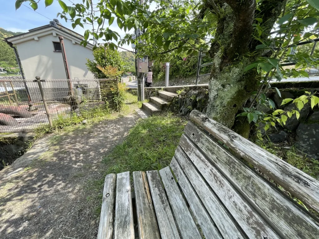
The spot fans come here for is the bench by the river that the campaign labels Igawa pumping station front (井川用水機場前) — the official name of the stamp point, and the one to use if you are asking anybody about it. It is often called “Kumiko’s bench” online, which is a nickname rather than an official name. What you want is the public footpath and the riverside: the pumping station behind the bench is a fenced utility site, not somewhere to visit.
- It is a shared path. Byodoin itself sends visitors along it between its two gates. Leave room, and keep bags off the benches other people want to sit on.
- Keep off the water’s edge. Stay on the path rather than the stonework by the river, and follow any warning signs posted along it.
The islands, Kisenbashi and Asagiribashi
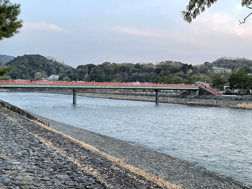
Mid-river, Kyoto Prefecture’s Uji Park takes in two islands, Tachibanajima and Tonoshima. From the west bank you cross by Kisenbashi or Tachibanabashi; from the east bank, by the vermilion Asagiribashi. Uji City gives the islands as about ten minutes on foot from the bridge. They are parkland, and the thirteen-storey stone pagoda on Tonoshima is the landmark in the middle of them.
Asagiribashi is the footbridge from Tachibanajima to the east bank, and it lands in front of Uji Shrine. Kanryubashi is also on the official map but not on the loop described here; check its position on the leaflet if you want to add it.
The east bank: Uji Shrine and Sawarabi-no-michi
Uji Shrine stands where Asagiribashi reaches the east bank, and it is on Keihan’s location map. It is a working shrine: keep to the paths, leave the approach clear for people coming to pray, and keep your voice down in the grounds.
From the shrine, Sawarabi-no-michi leads on towards Ujigami Shrine and the Tale of Genji Museum. It is the link between the riverside part of the walk and everything above it, including the way to the hill.
Daikichiyama lookout
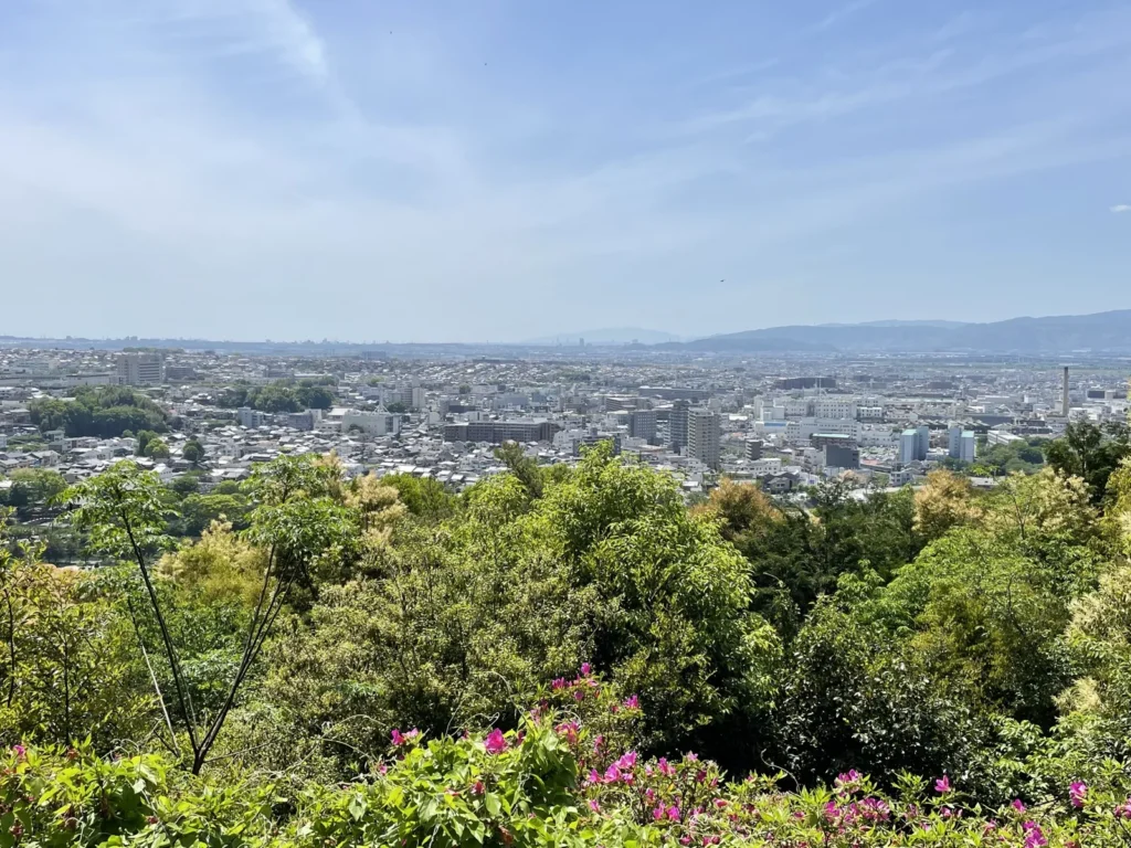
Daikichiyama is the hill above the east bank, close to Ujigami Shrine, and its lookout is on Keihan’s location map and a stamp point in the campaign’s first half. The Kyoto Prefectural Tourism Federation gives about twenty minutes from the trailhead to the lookout. That covers the climb only: the walk from the river to the trailhead and the way back down come on top of it.
- It is a mountain path, not a promenade. The official map asks for shoes you can walk a trail in.
- Daylight only. There is no lighting on the path, and the official advice is to climb in the daytime. A night-time climb is not something this guide builds a route around.
- Quiet, and take your litter home. Both are asked for on the official map, and the houses below the hill are close enough to hear voices from the lookout.
How to Get to Uji
Two railways reach Uji and they arrive in different places. JR comes down from Kyoto Station on the Nara Line to JR Uji, west of the river and ten minutes from the bridge. Keihan comes from central Kyoto and Osaka along the other side of the valley to Keihan Uji, on the east bank right beside the bridge. Pick the one that matches where you are staying and where you are going afterwards, and read the last section here before you plan your way back.
From Kyoto Station
The JR Nara Line runs south from Kyoto Station to JR Uji in about 16 minutes on a rapid service, which is the figure Uji City publishes; local trains take longer and stop more. Check the last useful train back if you are staying into the evening. Buy at the machine or tap in with an IC card.
The same line passes Inari, for Fushimi Inari Taisha: Uji City gives Inari to Uji as about 17 minutes on a local train, which is what makes the two a sensible pair in one day.
From Gion-Shijo and central Kyoto
From Sanjo or Gion-Shijo in central Kyoto, the trip is about 30 minutes with a change at Chushojima onto the Uji Line, again the city’s own figure. Keihan’s fare table, revised on 1 October 2025, gives Gion-Shijo to Uji at 360 yen for an adult one way, so 720 yen for the round trip.
From Osaka, Keihan runs from Kyobashi to Uji in about 51 minutes, change at Chushojima.
From Kansai International Airport
Take the Haruka limited express from Kansai-airport Station to Kyoto, then the Nara Line as above. Haruka is a limited express: as JR-West’s own English guide sets out, you need a limited express ticket in addition to the basic fare ticket, and both can be bought at the ticket machines or the JR-West ticket office in the airport station.
Start counting from Kansai-airport Station, once you are through immigration and have your bags: the train legs are Haruka to Kyoto and the Nara Line on to JR Uji. What varies is the connection at Kyoto — the walk between platforms, the wait for the next train and any queue for tickets — so look up both trains for your own arrival rather than relying on a single total.
From Osaka Itami Airport
Itami is the domestic airport. Check the airport’s own access page for the current connections to Kyoto Station on the day you fly, then take the Nara Line as above.
Which station is which
- JR Uji — west bank, about ten minutes’ walk from the bridge, on the line to and from Kyoto Station and Nara. The Nakamura Tokichi main shop is on this side.
- Keihan Uji — east bank, beside the bridge, at the end of the Uji Line. For central Kyoto and Osaka, changing at Chushojima.
- They are not the same station and not next to each other. If you came from Kyoto Station on JR, go back from JR Uji unless you have a reason to use Keihan: walking to the wrong one at the end of the day costs you the ten minutes plus a fare on a line that does not go where you are staying.
Passes, and when they are worth it for this trip
- Work out the fares before buying a pass. From Gion-Shijo the Keihan round trip is 720 yen; from Kyoto Station it is two JR single fares. A pass only helps if the rest of your day adds enough rides to it.
- The collaboration ticket is a Keihan product. The autumn 2026 campaign includes a one-day Keihan-line ticket at 1,700 yen for adults, on sale from 17 October 2026 until 31 March 2027, 6,000 issued, sold at Yodoyabashi, Kyobashi, Hirakatashi, Chushojima, Tanbabashi and Sanjo — not at Uji. It pays only if you are riding a lot of Keihan that day, and it is not valid on JR.
- Check what your own pass covers. Keihan is a separate railway from JR, so a JR pass takes you onto it only if its own terms say so. JR-West’s Kansai Area Pass, which covered Haruka and came with vouchers for a Keihan one-day pass, stopped being sold on 30 September 2026. A pass bought by that date stays valid for its stated period, and its Keihan benefit still has to be exchanged for a separate one-day ticket at a Keihan station counter rather than used at the gate. Do not plan around buying one now.
Best Way to Get Around
Verdict for this route: walk it. The riverside places are a loop between the two stations, which sit on opposite banks, and the hill is a footpath climb from the east bank. A bus joins the two stations, but nothing else in this guide needs one.
On foot
The city’s own distances are the ones to plan with: the bridge is ten minutes from JR Uji and immediate from Keihan Uji, Byodoin is five minutes from the bridge’s western end, Ujigami Shrine ten minutes from the eastern end, and the islands ten minutes from the bridge. Those are the figures the itinerary estimates are built on; the hill adds its own climb and descent on top.
Using both stations in one day
Arriving at one station and leaving from the other is a tidy way to walk the loop without doubling back — in at JR Uji, out from Keihan Uji, or the reverse. It only works if the second station is on a line that serves where you are going next. From Kyoto Station, that is JR both ways; from Gion-Shijo, Keihan both ways.
Buses and taxis
City buses connect the stations with the outer parts of Uji, and the autumn campaign has put collaboration signage on some stops, but nothing in this guide needs one. The exception worth knowing is route 64, the Uji–Ogura line, which circulates via Keihan Uji and JR Uji: it joins the two stations without the walk. A taxi can cover the distance between a station and the river for anyone who cannot walk it, but the lookout is on a footpath, so the climb itself has no shortcut.
Car
Uji City asks visitors to come by train in the busy seasons, and publishes a map of the paid car parks around the river because the streets near the bridge are not built for queueing traffic. Byodoin has no visitor car park of its own. If you are driving in Kansai anyway, park once and walk; otherwise leave the car.
How flat is it, really
Most of the walk is along the river and through the shopping streets, but “no car needed” is not the same as step-free, and Daikichiyama is a footpath climb. Byodoin publishes its own access information: the garden paths are gravel, it lends wheelchairs built for them at both gates, and the Phoenix Hall interior and part of the garden have steps that a wheelchair cannot pass. For the shrines and the bridges to the islands, check on the day if steps matter to you.
What to Eat and Drink in Uji
Uji is a tea town, and the eating here is built around it: matcha in a bowl, matcha in ice cream, matcha in noodles. The two streets to look in are the Byodoin Omotesando on the west bank and the approach to Uji Bridge.
Matcha, and where to sit down with it
Nakamura Tokichi‘s main shop is one sit-down option, on the JR Uji side of the river at 10 Uji-Ichiban. Its own site gives the tea counter and the café as 10:00 to 17:30, last orders 16:30, with the waiting list closing at 16:00; it does not take reservations and says it may stop taking names earlier when it is busy. In practice that means a queue at weekends and through the autumn, so treat it as a plan for early in the day rather than something to slot in at four o’clock. Its Byodoin branch on the Omotesando is a different, smaller shop with its own hours.
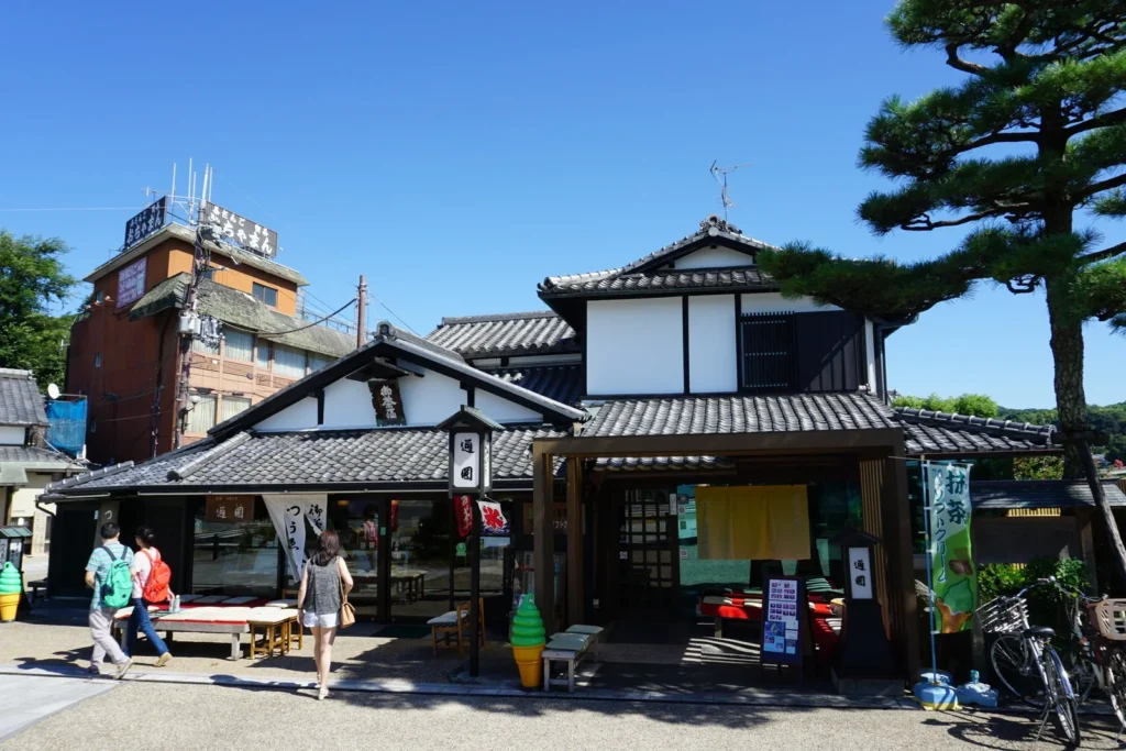
Tsuen, at the eastern end of the bridge, is the tea house in the photograph above.
A tea room you can book: Taihoan
If you want the formal version rather than a café, the city runs Taihoan, a municipal tea room opposite the Uji City Tourist Centre. The tourism association’s page gives the current terms: open 10 January to 20 December, 10:00 to 16:00, with the last day of each month closed for maintenance. Usucha, the everyday thin matcha, is 1,500 yen with a seasonal sweet, takes about 20 to 30 minutes, seats ten at a sitting, and can be taken on the day as well as booked. The thicker koicha set at 4,000 yen needs booking three days ahead for two or more people, and the sencha sittings run about four days a month and take longer.
Bookings go through the association’s form, and you exchange them for a ticket at the tourist centre across the way. Check the calendar on the page for your date: the closed day moves with the month, and the tea on offer alternates between matcha and sencha.
Chasoba, and the sweet end of it
Chasoba — buckwheat noodles made with tea — is the local lunch, and Nakamura Tokichi’s main shop serves soba as well as tea. Matcha sweets run from ice cream to parfaits and tea jelly; a takeaway is the faster option when the queue for a table is long.
Where the shops actually are
- Byodoin Omotesando — the approach street between the bridge and the temple gate, and the densest run of tea shops and cafés. It is a shopping street outside the temple; you do not need a temple ticket to walk it.
- The bridge approach and Uji-bashi-dori — the shopping street between JR Uji Station and the river, on the side of town where Nakamura Tokichi’s main shop is.
- Places close earlier than you might expect. Nakamura Tokichi’s main shop closes at 17:30 with last café orders at 16:30, and Byodoin’s own tea room takes its last orders at 16:00. Check the hours of anywhere you are counting on for a late lunch or an evening meal.
Beyond the Anime: More to See
These are ordinary Uji sightseeing, kept separate from the series locations in this guide. By Uji City’s figures, Byodoin is five minutes from the western end of Uji Bridge and Ujigami Shrine ten minutes from the eastern end.
Byodoin and the Phoenix Hall
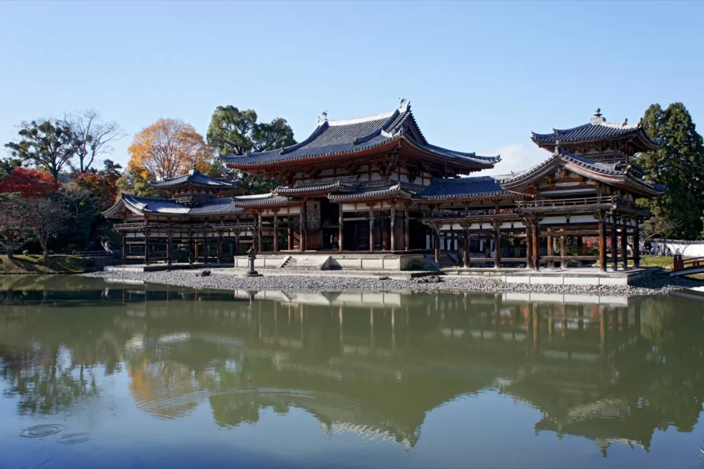
The temple on the west bank is a UNESCO World Heritage site. Its own pages give the terms, and they are worth reading before you go because the hall and the garden are sold separately:
- Garden and the Hoshokan museum: 700 yen for adults, 400 for junior and senior high school students, 300 for primary school children. There is no garden-only ticket.
- Hours: the garden 8:45 to 17:30, last admission 17:15; the museum 9:00 to 17:00, last admission 16:45. Both are on Byodoin’s own visitor page, which is where to confirm them for your own date.
- Inside the Phoenix Hall is a separate 300 yen, with timed tickets sold inside the garden from 9:10, first come, for visits between 9:30 and 16:10 every twenty minutes. From 16 October 2026 the temple cut each group from 50 people to 35, and says in the same notice to expect longer waits than before in the spring and autumn seasons. It publishes a waiting-time chart by month on the temple’s interior-viewing page; an hour or more is normal when it is busy.
- Re-entry is not normally allowed — but the same notice makes one exception: if you hold a Phoenix Hall ticket you can leave and come back by showing it to staff at the reception gate, so a long wait can be spent outside. That stops once you have done the interior viewing, and a missed slot cannot be changed or refunded.
- How long it takes: the temple’s own guidance puts the exterior and the museum at about 40 minutes, or 90 to 120 minutes with the sub-temples, the shop and the tea room. The interior viewing itself is about 15 minutes, on top of the wait.
The practical reading of that: put Byodoin first in the morning if you want the interior, and do not build the rest of the day around getting in. The hall seen across the pond from the garden needs no interior ticket.
Ujigami Shrine
Ujigami Shrine, along Sawarabi-no-michi from Uji Shrine, is the other World Heritage site here, and its main hall is a National Treasure. Do not confuse it with Uji Shrine, the shrine where Asagiribashi reaches the east bank, which is the one on Keihan’s map.
The Tale of Genji Museum
The ten Uji chapters at the end of the Tale of Genji are set here, and the city’s Tale of Genji Museum on the east bank is devoted to them. It is a reasonable rainy-afternoon answer; check its own page for the current hours and closing day before you count on it.
The river, in season
The Uji tourism association’s own listings run from the cherry-blossom festival on the river in spring to cormorant fishing in summer, and the hills colour in late autumn. Uji City warns that the roads are heavily congested in Golden Week and the autumn season; the earliest train of the day is the simplest way round the crowds.
Souvenirs and Where to Buy Them
Tea, bought properly
Uji tea is the thing to carry home, and the shops along the Omotesando and the bridge approach will sell you matcha by the tin, gyokuro and sencha by weight, and hojicha, roasted until it turns brown and smells of toasted leaves. Matcha for whisking and matcha for cooking are different grades at different prices; say which you want. Sealed tins travel better than opened ones.
Sweets and the rest
Tea jelly, chocolate and baked sweets are the standard boxed gifts — Nakamura Tokichi sells all three — and the package says how long they keep. Uji also has its own pottery, Asahiyaki, so a tea bowl or a teapot is a heavier but longer-lived alternative.
For the series itself
Collaboration goods come and go with each campaign, and Keihan’s official site lists what is on sale and where while a campaign runs. Do not plan a day around a character good that may already have sold out.
Where to Stay
Most people do Uji as a day trip and sleep in Kyoto, which is the right answer for a first visit. The three choices differ in what they cost you in travel time rather than in money, and this guide does not quote room rates it has not checked.
Around Kyoto Station
The simplest base: the Nara Line leaves from here, so Uji is one ride each way, and everything else in Kyoto is also from this station. Choose it if Uji is one day in a longer Kansai trip.
Along the Keihan line
Gion-Shijo and Sanjo put you on the railway that runs to Uji with one change. Choose it if you are spending your nights in eastern Kyoto anyway — and if you hold a JR pass, check its terms for Keihan, which is a separate railway (see the passes box above).
Uji itself
Staying in Uji itself buys you the riverside early in the morning and in the evening, before and after the day trips. If you do, check what is open for dinner near where you stay, or choose an inn that serves it.
Suggested Itinerary
The choice here is not which places to see but how much of Uji you add to the riverside. Route A is the series walk and a tea stop. Route B keeps all of that and puts Byodoin at the front of the day and the hill in the middle of it. Both start and end at a station and neither needs a car.
| Which route | A — the riverside | B — the full day |
|---|---|---|
| Time | 3 to 4 hours, a planning estimate including walking, looking and one sit-down stop | 6 to 8 hours, a planning estimate on the same basis, with lunch and a climb |
| What you do | Bridge, west bank and the bench, the islands, Asagiribashi, Uji Shrine, tea on the way back | All of A, plus Byodoin in the morning, Ujigami Shrine, Sawarabi-no-michi and the Daikichiyama lookout |
| Transport | Train in, walk, train out. No car, no bus | The same. The only extra legwork is the hill |
| Book or check first | Nothing has to be booked. Check the tea room’s calendar if you want a formal sitting | Byodoin’s notices for the day, and the interior queue if the Phoenix Hall matters to you |
| Hardest part | No climb | Daikichiyama, about twenty minutes up a trail path from the trailhead |
A — the riverside half day
- Arrive at JR Uji. Walk down Uji-bashi-dori towards the river, about ten minutes.
- Agata Shrine, then the water. Inland from the Byodoin approach, then back out to the Ajirogi-no-michi along the west bank.
- The bench at the Igawa pumping station front. On the promenade, facing the river. Sit down, let other people past, and keep out of the fenced works behind it.
- Kisenbashi to the islands. Tachibanajima and Tonoshima, the pagoda, and the best view of the river from the middle of it.
- Asagiribashi to the east bank, then Uji Shrine. The vermilion footbridge lands in front of the shrine.
- Back over Uji Bridge for tea. The Omotesando and the bridge approach are both on the way to JR Uji; if you want a table at Nakamura Tokichi, go now rather than near its 16:00 cut-off for names.
- Finish at the station you came from. JR Uji for Kyoto Station, Keihan Uji if you are going back to Gion-Shijo.
B — the full day, with Byodoin and the hill
- Morning: Byodoin first. The garden opens at 8:45. If you want the Phoenix Hall interior, buy the timed ticket inside the garden from 9:10 and spend the wait in the museum rather than queueing twice.
- Late morning: the Omotesando and the west bank. Out of the temple’s gate, along the shopping street, then Agata Shrine, the promenade and the bench.
- Lunch. Chasoba or a tea-shop lunch on the Omotesando or the bridge approach.
- Early afternoon: cross to the east bank. Kisenbashi, the islands and Asagiribashi, then Uji Shrine at the foot of the slope.
- Sawarabi-no-michi and Ujigami Shrine. Uji City gives the shrine as about ten minutes on foot from the eastern end of Uji Bridge.
- Daikichiyama, in daylight. About twenty minutes up from the trailhead to the lookout by the prefecture’s figure, time at the top, and the same path down. Leave enough light for the descent.
- Tea to finish. Taihoan’s hours end at 16:00 and Nakamura Tokichi’s waiting list closes at 16:00, so this is the part of the day that needs watching if you climbed late.
- Back to your station. Keihan Uji is beside the bridge on the east bank; JR Uji is ten minutes across it.
Combining Uji with Fushimi Inari or Nara
Uji sits on the Nara Line between Kyoto and Nara, and Inari is about 17 minutes north of it on a local train. Route A plus Fushimi Inari is a comfortable day out of Kyoto; Route B is a day of its own. Nara is further down the same line, which makes Uji a sensible stop on the way rather than a detour, as long as you are not trying to add Byodoin’s queue to it.
Travel Tips and Etiquette
On the riverside and in the streets
- These are residential streets. The lanes behind the promenade and under the hill are people’s homes. Keep voices down, especially at night — Keihan’s own campaign notice asks exactly this of visitors.
- The pumping station is not an attraction. The bench and the path are public; the works behind the fence are not. Do not climb or lean on the fencing for a photograph.
- Photograph places, not people. Other visitors, residents and shop staff have not agreed to be in your shot, and shop interiors are private property.
On the hill
- Daylight, proper shoes, quiet, and take your rubbish with you — the four things the official map asks for. There is no lighting on the path.
At the shrines and the temple
- Uji Shrine and Ujigami Shrine are places of worship that happen to be on a pilgrimage route. Do not stand in front of the hall to photograph it while someone is praying, and follow any signs about where photography is allowed.
- Byodoin does not normally allow re-entry. Do everything inside the grounds in one visit, and use the riverside path outside to move between its two gates. The exception the temple publishes is a Phoenix Hall ticket, which lets you step out and back while you wait for your slot.
Practical
- IC cards work on JR and Keihan. Byodoin takes cards for garden admission, but by its own FAQ the Phoenix Hall desk and the seal office are cash only, so carry some.
- Rain changes the day. In wet weather, give the hill path a miss and spend the time in Byodoin’s museum or the Tale of Genji Museum instead.
Plan Your Trip
Do this first
- Pick A or B, then pick your station: JR Uji if you are coming from Kyoto Station, Keihan Uji if you are coming from Gion-Shijo or Osaka.
- If the Phoenix Hall interior matters, plan to be at Byodoin when the garden opens, buy the timed ticket first and then look at the garden and the museum while you wait. Groups were cut to 35 people on 16 October 2026, so read the temple’s notices for the day before you set out.
- If you want a formal bowl of tea, check Taihoan’s calendar for the closed day of that month and which tea is being served, and book the sitting if you want anything beyond usucha.
- If the campaign interests you, the official Keihan page is where the current dates, stamp points and goods are listed. Treat it as a bonus on top of the walk rather than the reason for the trip.
The autumn 2026 collaboration, in short
- Keihan’s current campaign with the series runs from 1 September 2026 and its digital stamp rally is split in two: 1 September to 31 October, then 1 November to 20 December 2026. The first-half points include the Igawa pumping station front, Uji Bridge and the Daikichiyama lookout; the second half moves to the river bank, Agata Shrine and Kowata Shrine.
- The paper location map has been given out since 1 September 2026 while stocks last, at major Keihan stations and at the tourist offices by both Uji stations.
- Campaign dates, tickets and goods change. Everything in this box is from the official page on the date below; the walk in this guide does not depend on any of it.
Combine it with another guide
- Detective Conan in Hokuei, Tottori — if you are heading west from Kansai.
- Makeine in Toyohashi and Your Name in Hida — both on the way back towards Tokyo if you are crossing the country.
- All published guides — the full list by work and region.
How this guide was put together
This guide was researched and planned from published sources rather than written up from a visit. Checked on 16 October 2026: Keihan’s official campaign site for the location map, the stamp-rally halves and dates, the collaboration ticket’s price and sale period, and the map’s own requests about the hill; Uji City for the public-transport times from Kyoto, Inari and the Keihan stations and for the walking times between the stations, the bridge, Byodoin, Ujigami Shrine and the islands; the Kyoto Prefectural Tourism Federation for the twenty minutes from the Daikichiyama trailhead to the lookout; Byodoin for its hours, its 700 yen garden and museum admission, the separate 300 yen Phoenix Hall viewing with its 9:10 ticket desk and 9:30 to 16:10 slots, the re-entry rule and the notice of 17 September 2026 that cut each interior group from 50 to 35 from 16 October 2026, with the re-entry exception for interior ticket holders; the Uji City Tourism Association for Taihoan’s season, hours, prices and booking terms; Nakamura Tokichi for its main shop’s hours and its no-reservation policy; Keihan’s fare table of 1 October 2025 for the 360 yen Gion-Shijo to Uji fare; JR-West’s English guidance for the Haruka limited express ticketing and its Kansai Area Pass page for the Keihan exchange voucher and the end of sales on 30 September 2026; Ito En’s tea FAQ for the fact that hojicha contains caffeine; Kyoto Animation’s official site for the series; and the Uji tourism association for route 64 and its seasonal listings.
What is an estimate, and what could not be confirmed. The 3-to-4-hour and 6-to-8-hour figures are editorial planning estimates built from the published walking times and opening hours, not official durations; your own pace, the queues and the season will move them. No JR fare is quoted because none was confirmed from JR’s own table at the time of checking. No door-to-door time from either airport is given: the guide names the train legs from Kansai-airport Station and leaves the connection at Kyoto to your own timetable, and the connections from Itami are left to the airport’s own page, which could not be read on the day of checking. The Daikichiyama lookout, Kisenbashi and Kanryubashi have no published position that could be confirmed, so the lookout is listed with a name search instead of a pin and the two bridges are described in the text only. The bench on the promenade is identified by the official stamp-point name rather than by any nickname, and no attempt is made to match individual scenes to individual benches.
Written and edited by Nick, who runs Anime Routes Japan from Japan. More about Nick, and about how these guides are made, is on the About page.
Opening hours, fares and admission prices change, and tea rooms and small shops change faster than anything else. Confirm the ones your day depends on before you travel, and check the temple’s and the city’s own notices for closures on the day you are going.
This guide currently contains no affiliate links.